
Map of Lampung
Map of Lampung – The area of Lampung Province looks very small, This is due to the size of the island of Sumatra, even though in reality the province of Lampung is very wide. For more details, see the complete Lampung map material with explanations, city and county name.
Table of Contents
Map of Lampung
Lampung is a province located in the southernmost part of Sumatra Island, in the north directly adjacent to Bengkulu & South Sumatra.
Which Bandar Lampung is currently the provincial capital which is a combination of the twin cities of Tanjung Karang & Betung Bay.
Lampung Province has as many regencies as 13 County with 2 Kota. The total area of Lampung province is: 35.587 km2.
Based on population census data, the population of the population in Lampung Province reached 8.205.141 soul.
The following is a picture of the Lampung Map which we will display in this article, It is hoped that this will help you get to know Lampung Province through a map image. Read Also : World map
Complete Lampung Map
The area of Lampung Province looks very small, This is due to the size of the island of Sumatra, even though in reality the province of Lampung is very wide.
Coupled with various natural appearances that are very beautiful and varied. For more details, here is a map of Lampung province which we will present in full.
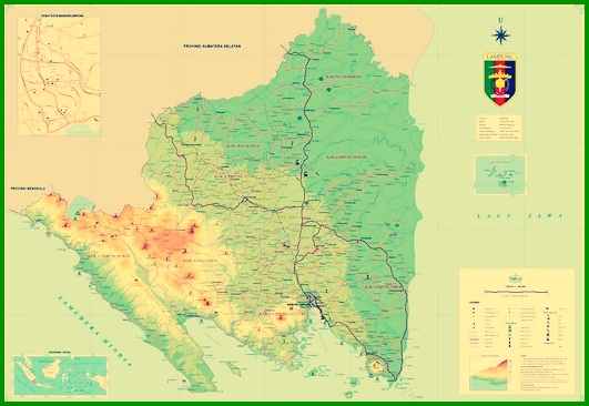
1. Lampung Province Map
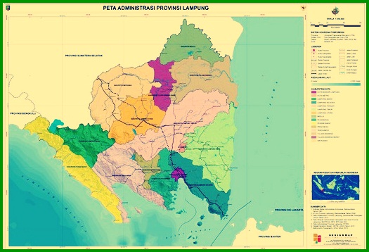
2. Lampung Province Administrative Map
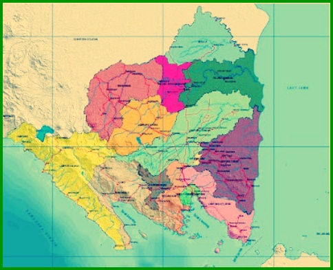
3. Map of Lampung Regency and City
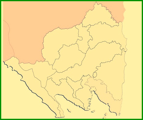
4. Lampung Blind Map
5. High Resolution Lampung Map
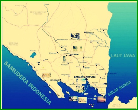
From the map of Lampung province above, we can know the boundaries of its territory & its location is located in the southernmost island of Sumatra. Read Also : Indonesian map
Lampung Province is directly adjacent to South Sumatra Province which is to the north, with the Java Sea to the east, Sunda Strait to the south, and the Indian Ocean lies to the west.
Lampung Regency
Lampung has 13 district and have 2 kota. As for the name of the district, an area, and government centers will be presented in the table below :
| You probably already know this information | An area | Central government |
| West Lampung | 2.142 km2 | Death |
| South Lampung | 700,3 km2 | Kalianda |
| central Lampung | 3.802 km2 | Mount Suhih |
| East Lampung | 5.325 km2 | Sukadana |
| North Lampung | 2.725 km2 | Earth City |
| Mesuji | 2.184 km2 | Mesuji |
| offer | 2.243 km2 | Building arrangement |
| West Coast | 2.907 km2 | Krui |
| Pringsewu | 623 km2 | Pringsewu |
| Tanggamus | 3.020 km2 | Great City |
| Onion bones | 3.466 km2 | Gala |
| West Onion Bones | 1.201 km2 | Middle Onion Bone |
| Way Kanan | 3.921 km2 | Blambangan Umpu |
City in South Sumatra Province
The following is a list of cities in the province of South Sumatra :
- City of Bandar Lampung has an area 296 km2, with a total population of 1.175.397 soul.
- Subway cat has an area 61,7 km2, with a total population of 165.368 soul.
The small islands of Lampung
As discussed earlier, The area of Lampung Province is approx 35.376,50 km². To the west of Lampung is bordered by the Sunda Strait, and to the east directly adjacent to the Java Sea.
Lampung province, in which Lampung there are lots of small islands in it, as for the small islands among them :
- Sebes Island
- Poahawang Island
- Tabuan Island
- Tampa Island
- Krakatoa Island
- Broken Island
- Pulau Darot
- Legundi Island
- Tegal Island
- Sebuku Island
- Ketagian Island
- Banana Island
The western part along the coast of Lampung Province is a hilly area which is a series of Bukit Barisan.
In the central region of the lowlands, & to the east is the vast waters of the Awa sea.
The name of the mountain in Lampung
Same with other provinces in Sumatra, Lampung province also has a large number of mountains, As for the mountains in Lampung province, among others :
Mountain List 1 :
- Mount Sekincau Liwa, located in West Lampung, with height 1.718 m (5.636 at the foot of Mount Pesagi in Liwa, located in West Lampung, This mountain has a height 2262 m.
- Mount Seminung in Sukau, located in West Lampung, This mountain has a height 1.881 m
- Guess Mountain in Sumberjaya, located in West Lampung, with height 2.115 m
- Mount Rindingan on Stage Island, located in Tanggamus, This mountain has a height 1.506 m
- Mount Pesawaran in Kedondong, located in Pesawaran, This mountain has a height 1.662 m)
Mountain List 2 :
- Mount Betung in Betung Bay, located in Bandar Lampung, This mountain has a height 1.240 m
- Mount Rajabasa in Kalianda, located in South Lampung,with the height reached 1.261 m
- Mount Tanggamus in Kota Agung, located in Tanggamus, with the height reached 2.156 m
- Mount Krakatoa in the Sunda Strait, located in South Lampung, with height 2.000 meter
- Mount Ratai in Padang Cermin, located in Pesawaran, with the height reached 1.662 m
There are also rivers, among others, as follows :
- Way Sekampung, have long reach 265 km
- Check Way, have long reach 90 km
- White Way, have long reach 190 km
- Way Jepara, have long reach 50 km
- Onion Bone Way, have long reach 136 km
- Way Mesuji, have long reach 220 km

The following is a list of mountains in Lampung province :
1. Mount Sekincau Liwa
2. Seminung Mountain
3. Guess Mountain
4. Mount Rindingan
5. Mount Krakatau
6. Mount Pesawaran
7. Ratai Mountain
8. Mount Tanggamus
9. Mount Rajabasa
10. Mount Rajabasa
1. City of Bandar Lampung, an area 296 km2, with a total population of 1.175.397 soul.
2. Subway cat has an area 61,7 km2, with a total population of 165.368 soul.
Thus our explanation of Lampung Map Material Complete with Explanations. Don't forget to always visit our website so that you can get a lot of knowledge. Thank you.
The post Peta Lampung appeared first on YukSinau.co.id.