Territory and Territorial Concept
What is the concept of territory and zoning? What are formal areas and functional areas? What are the benefits of the area? Nah, if this is the question, friend, Yuksinau.co.id, then see our explanation of the complete Regional and Territorial Concept Material below.
Table of Contents
Territory Definition
According to Taylor, a region is a part of the earth's surface that is distinct and characterized by other properties.
According to Government Decree No 47 year 1997 on National Spatial Planning, an area is a geographic entity with all related elements, whose boundaries and systems are determined based on administrative aspects and / or functional.
It can be concluded that a region is an area on the surface of the earth that is bounded by a certain appearance/appearance that is unique and distinguishes the region itself from other regions.. As an example, Forest areas are different from agricultural areas, urban areas are different from rural areas.
Territory Division

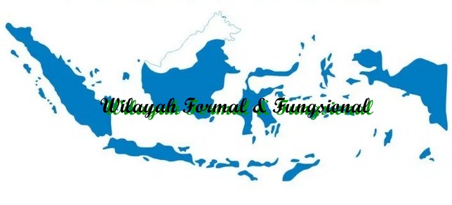
a. Formal Territory / Uniform Region
Region characterized by a degree of uniformity or homogeneity. For example based on physical or natural criteria as well as socio-cultural criteria.
- formal territory (unifrom region) based on physical criteria based on similarities in topography, rock, climate & vegetation. For example, limestone mountains (karst), cold climate and areas of mangrove vegetation.
- Formal area based on socio-cultural criteria, such as the Banjar tribe area, textile industry area and rice planting area / wet rice farming.
b. Functional Area / Nodal Region
Region characterized by activities that are functionally connected between several centers of activity functionally. As an example, Jabodetabek area is physically different (heterogeneous) but functionally interconnected to meet the needs of life in each region.
Territorial Definition
Territory / regionalization is a process of classifying areas or areas based on certain criteria. An area classification or classification can be formal or functional.
In process/development planning, The government needs to understand the conditions and circumstances of an area, because each region has different conditions.
The line classification of regions/regions is divided into::
- Natural/physical area (Natural Region) – Natural appearance, such as agriculture and forestry.
- Single Appearance Region (Single Feature Region) – Based on an appearance, for example. Regions by climate, animals or even just the climate.
- Region Based on Type (Generic Region) – Based on the appearance of a particular type or topic/theme. For example, in tropical rain forest areas where only certain plants such as orchids.
- Specific or Special Territory (Specific Region) – Characterized by a distinctive graphic condition that has to do with place, adat, culture and society in general. For example in Southeast Asia, Eastern Europe etc.
- Region Factor Analysis (Factor Analysis Region) – Based on statistical-descriptive methods or with statistical-analytic methods. Determination of areas/areas based on factor analysis is primarily aimed at productive matters, such as determining the area to be planted with corn and potatoes.
Territorial Benefits
- Sort and simplify information about the diversity and symptoms or phenomena that occur on the surface of the earth.
- Even distribution of development in all regions/regions so as to reduce differences and disparities between regions.
- Facilitate and facilitate the coordination of various development programs in each region.
- Observe the changes that occur, both natural and human phenomena.
Read Also : Environmental Benefits
Regional Growth Center Theory
The relationship between the concept of area and zoning with growth center development planning is very closely related to the growth of various regions on the earth's surface, do not grow together regularly, but there is a section, either intentionally or not, some grow and develop faster than others. Here are some theories about growth centers.
a. Central Place Theory
A German geographer, Walter Chisstaller (1993) and German economists, August Losch (1945) explained that the central location is a place that allows all human activities to be maximized, either in service activities or who are consumers of the goods and services produced.
b. Growth Pole Theory
The growth pole is a development strategy carried out through or by transmitting regional development from the periphery center (Center Down Development).
The theory was first put forward in 1950 oleh Francois Perroux, an economist from France.
In the year 1972, Bou Deville promotes the concept of growth as proposed by Perroux, which is called theory Engine of Economic Growth (Indonesian: Economic Growth Engine).
According to Taylor, a region is a part of the earth's surface that is distinct and characterized by other properties.
According to Government Decree No 47 year 1997 on National Spatial Planning, an area is a geographic entity with all related elements, whose boundaries and systems are determined based on administrative aspects and / or functional.
It can be concluded that a region is an area on the surface of the earth that is bounded by a certain appearance/appearance that is unique and distinguishes the region itself from other regions.. As an example, Forest areas are different from agricultural areas, urban areas are different from rural areas.
a. Formal Territory / Uniform Region
Region characterized by a degree of uniformity or homogeneity. For example based on physical or natural criteria as well as socio-cultural criteria.
formal territory (unifrom region) based on physical criteria based on similarities in topography, rock, climate & vegetation. For example, limestone mountains (karst), cold climate and areas of mangrove vegetation.
Formal area based on socio-cultural criteria, such as the Banjar tribe area, textile industry area and rice planting area / wet rice farming.
b. Functional Area / Nodal Region
Region characterized by activities that are functionally connected between several centers of activity functionally. As an example, Jabodetabek area is physically different (heterogeneous) but functionally interconnected to meet the needs of life in each region.
1. Sort and simplify information about the diversity and symptoms or phenomena that occur on the surface of the earth.
2. Even distribution of development in all regions/regions so as to reduce differences and disparities between regions.
3. Facilitate and facilitate the coordination of various development programs in each region.
4. Observe the changes that occur, both natural and human phenomena.
That's our explanation of the Paper Material Territory and Territorial Concept. Read it too Distribution of Fauna in the World. May be useful.
The post Concept of Territory and Zoning appeared first on YukSinau.co.id.
